Alaska PaleoGlacier Atlas
Pleistocene glacier extents in Alaska
|
Alaska PaleoGlacier Atlas Pleistocene glacier extents in Alaska |
| All geospatial data presented on this webpage from the APG Atlas V2 is also available from the NOAA Paleoclimate Database here. |
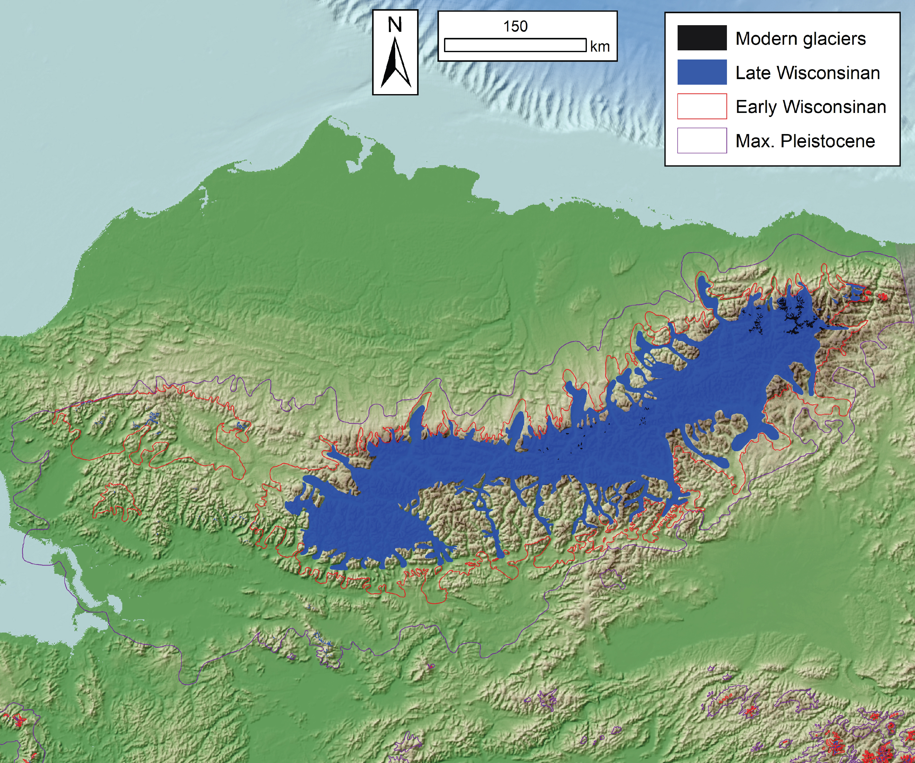
MIS 2 (late Wisconsinan) glacier extents in Alaska
|
kmz google earth file pgn ESRI polygon shapefile pln ESRI polyline shapefile
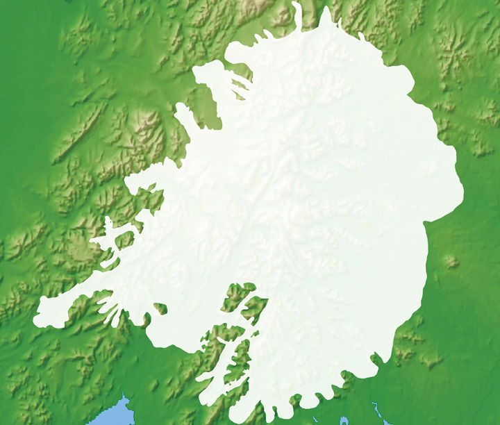
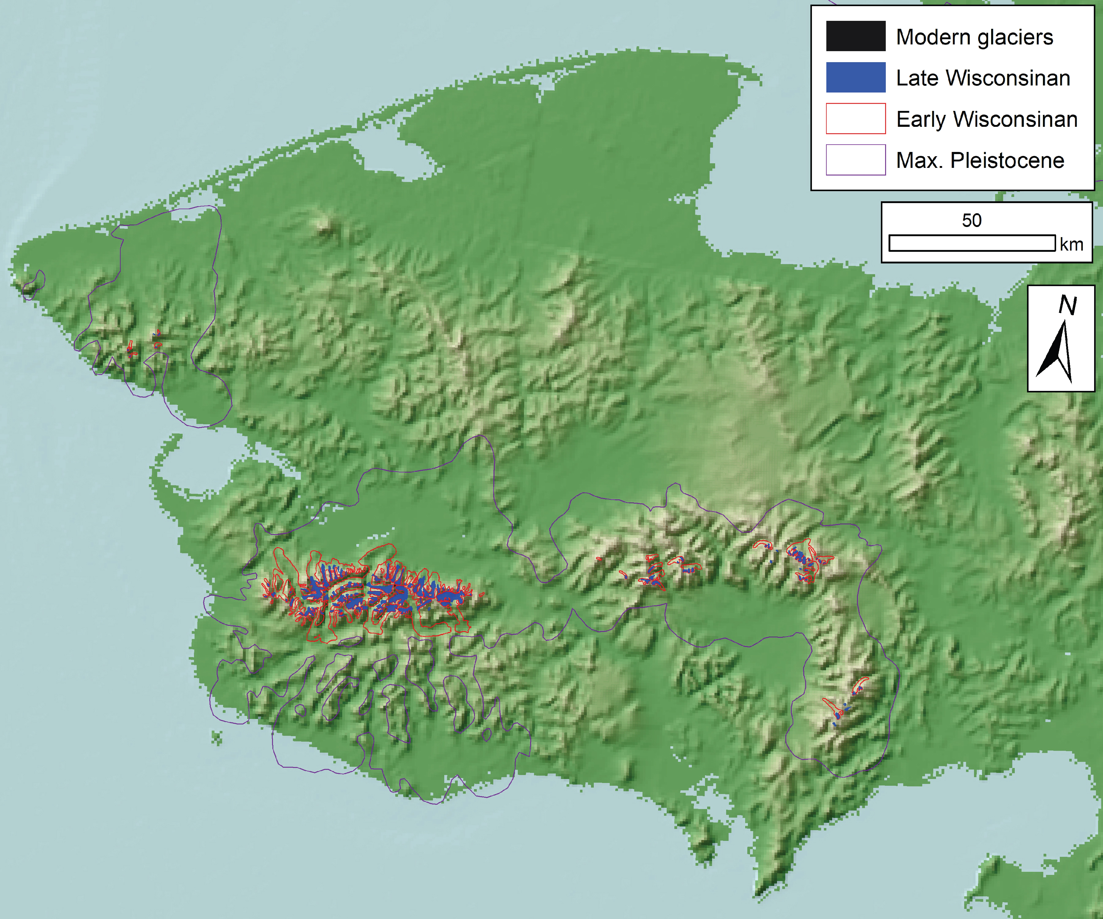
right example: Ahklun Mountains, Southwestern Alaska |
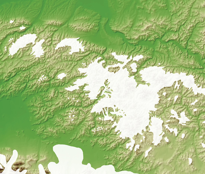
MIS 4 (early Wisconsinan) glacier extents in Alaska
|
kmz google earth file pgn ESRI polygon shapefile pln ESRI polyline shapefile
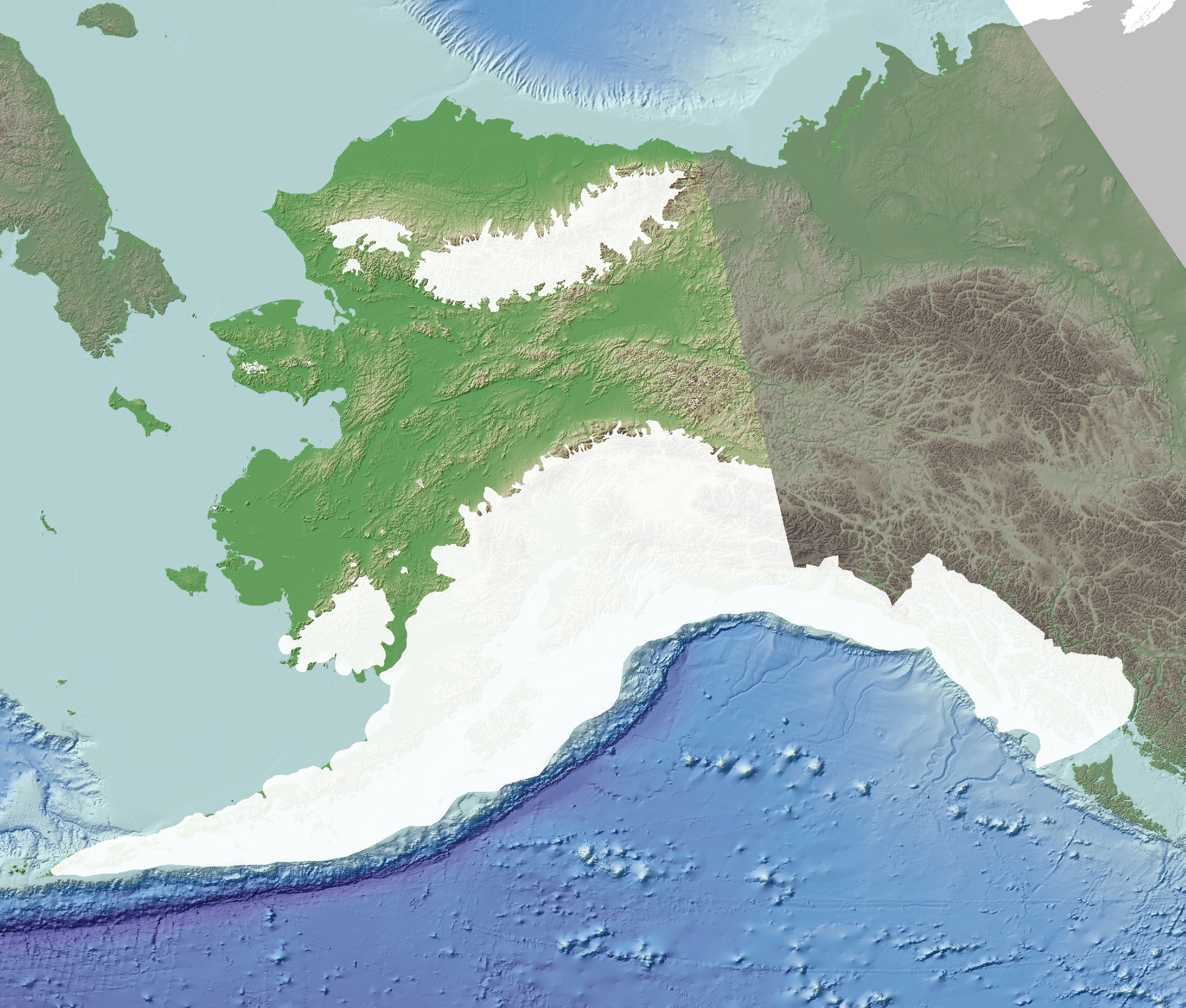
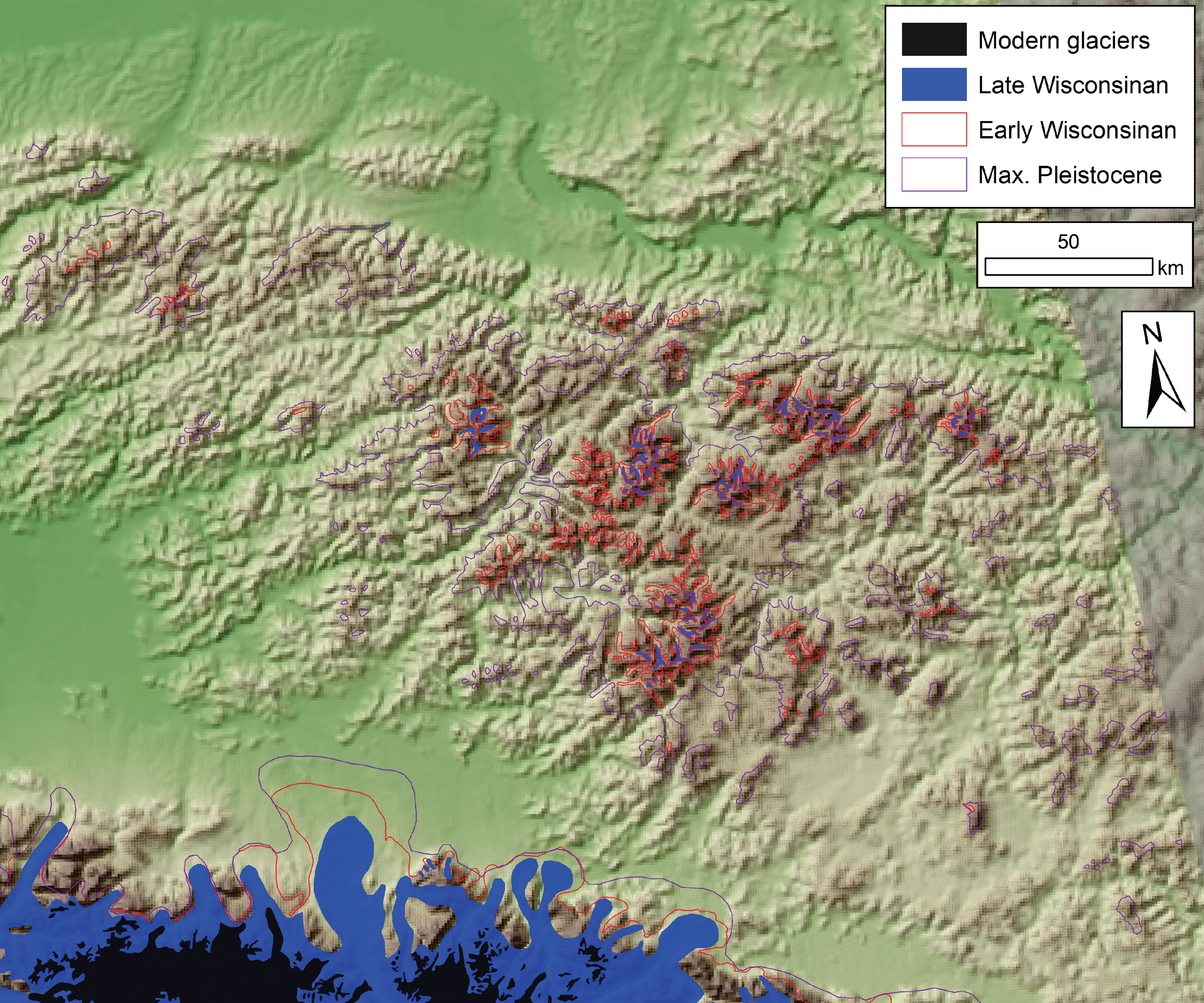
right example: DeLong Mountains, Northwestern Alaska |
Maximum Pleistocene glacier extents in Alaska
|
kmz google earth file pgn ESRI polygon shapefile pln ESRI polyline shapefile
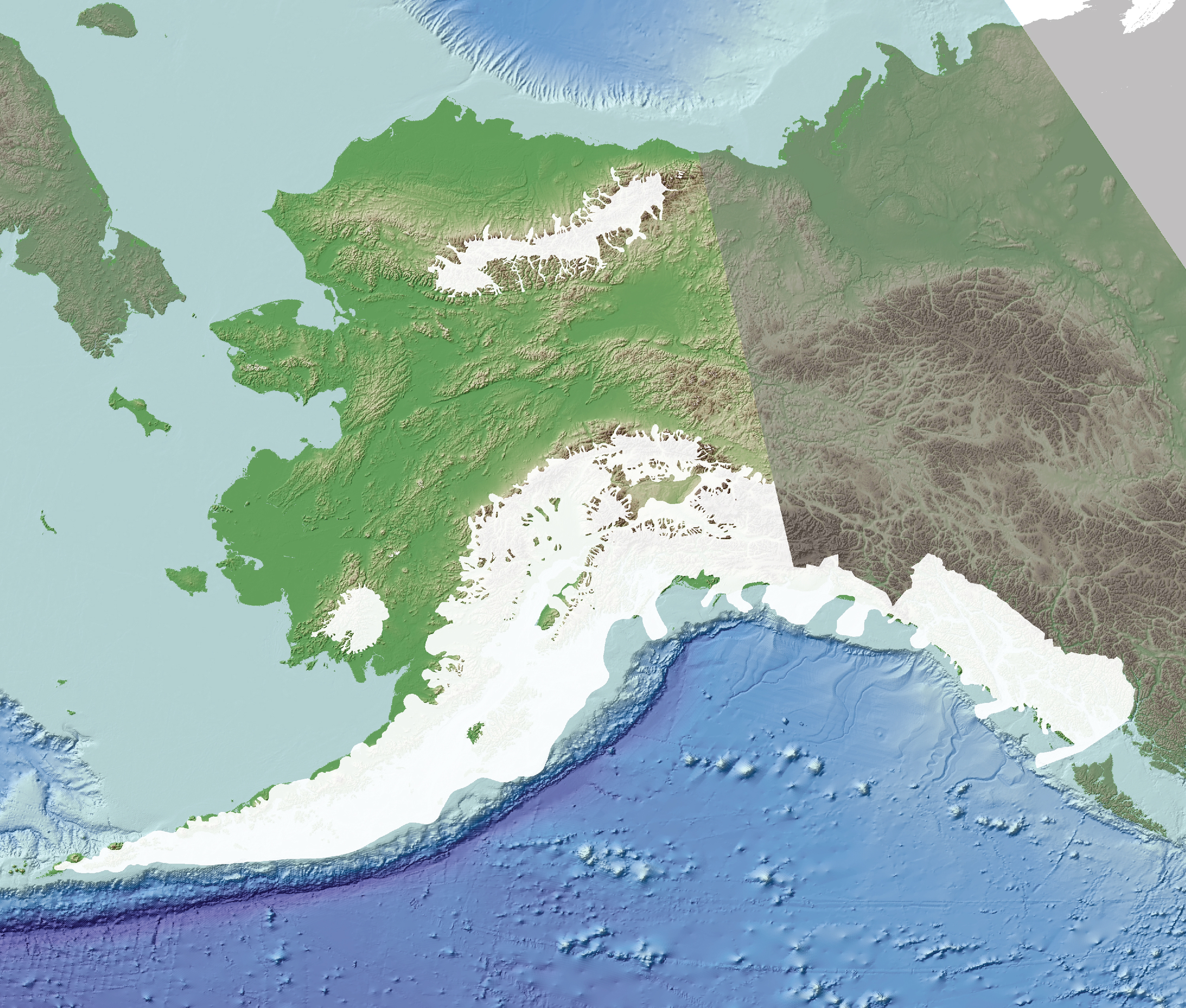
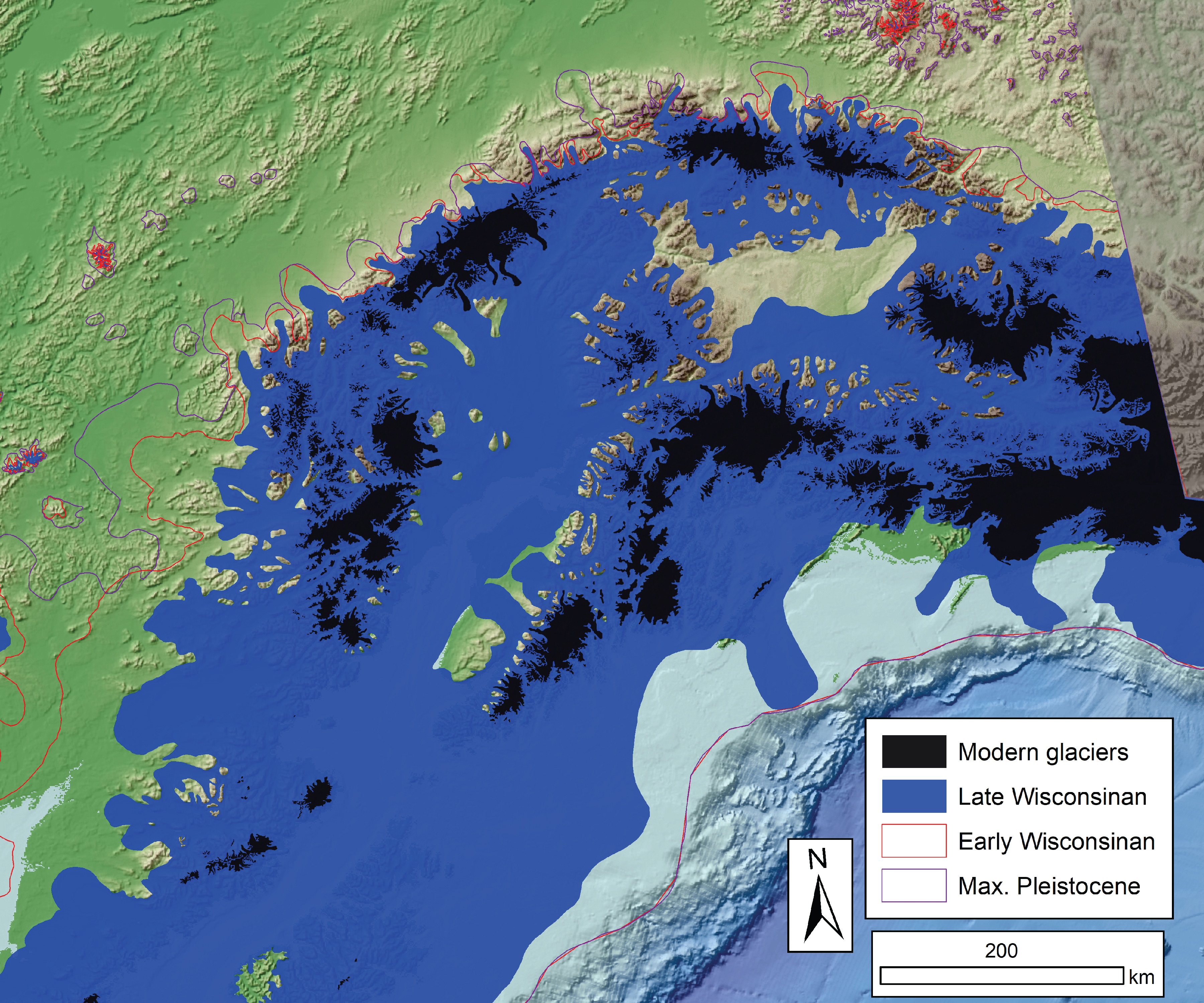
right example: The Yukon-Tanana Upland |
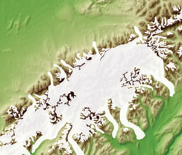
Modern glaciers in Alaska
|
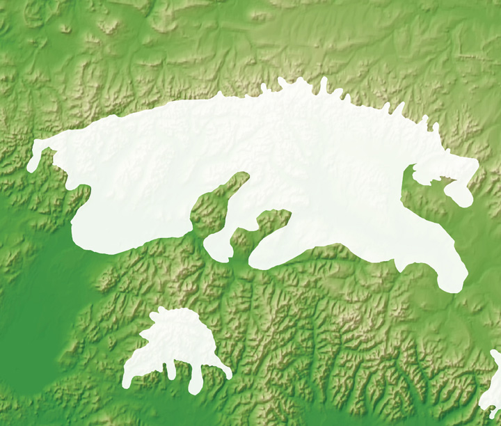
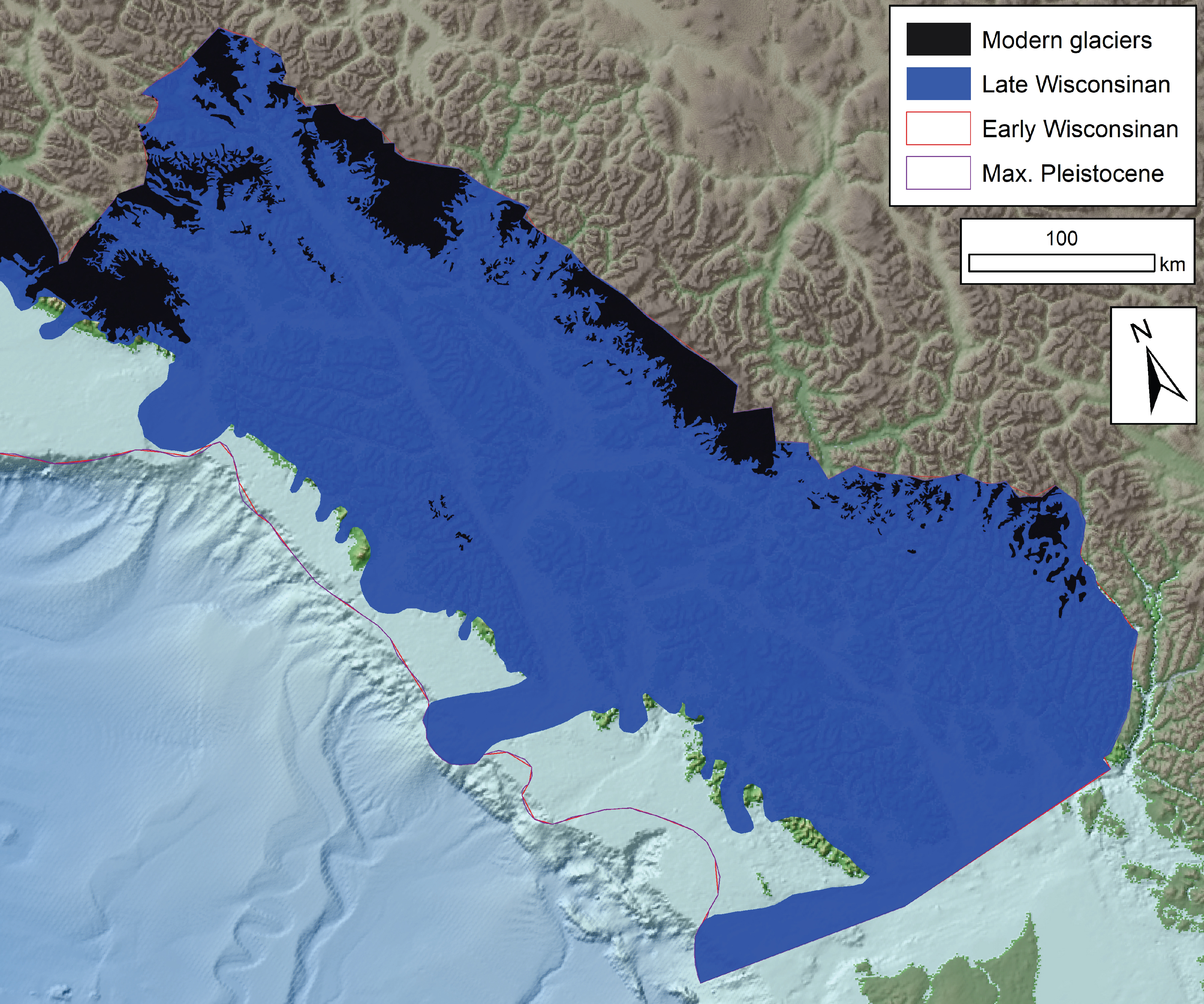
Modern glaciers provided by Randolph Glacier Inventory v 6.0 kmz google earth file pgn ESRI polygon shapefile pln ESRI polyline shapefile data available from the Randolph Glacier inventory v. 6.0 right example: Denali National Park, central Alaska Range |
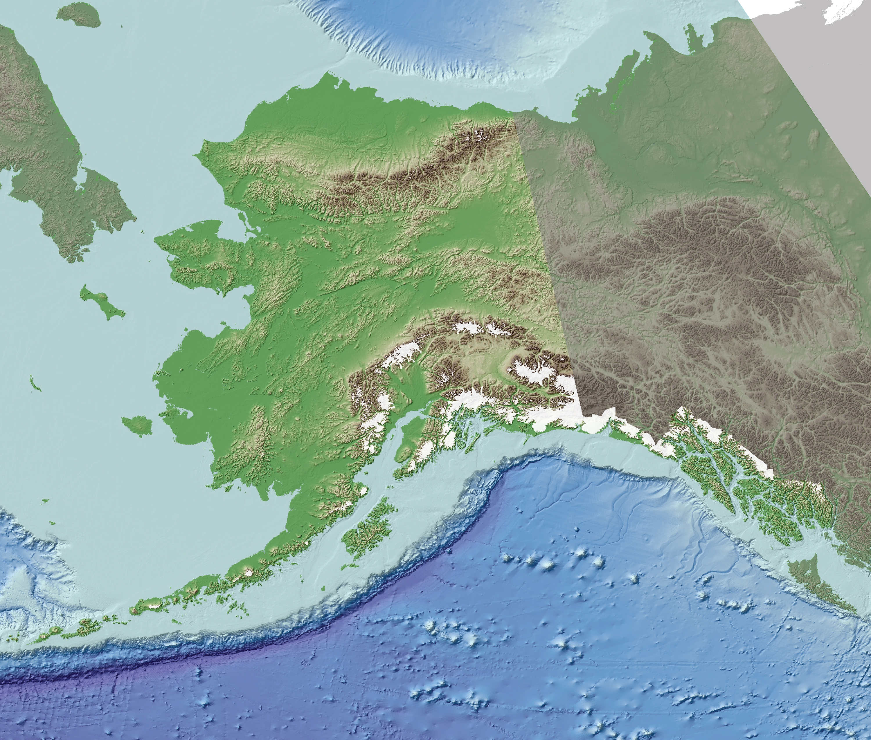
Alaska PaleoGlacier Atlas complete map
|
|
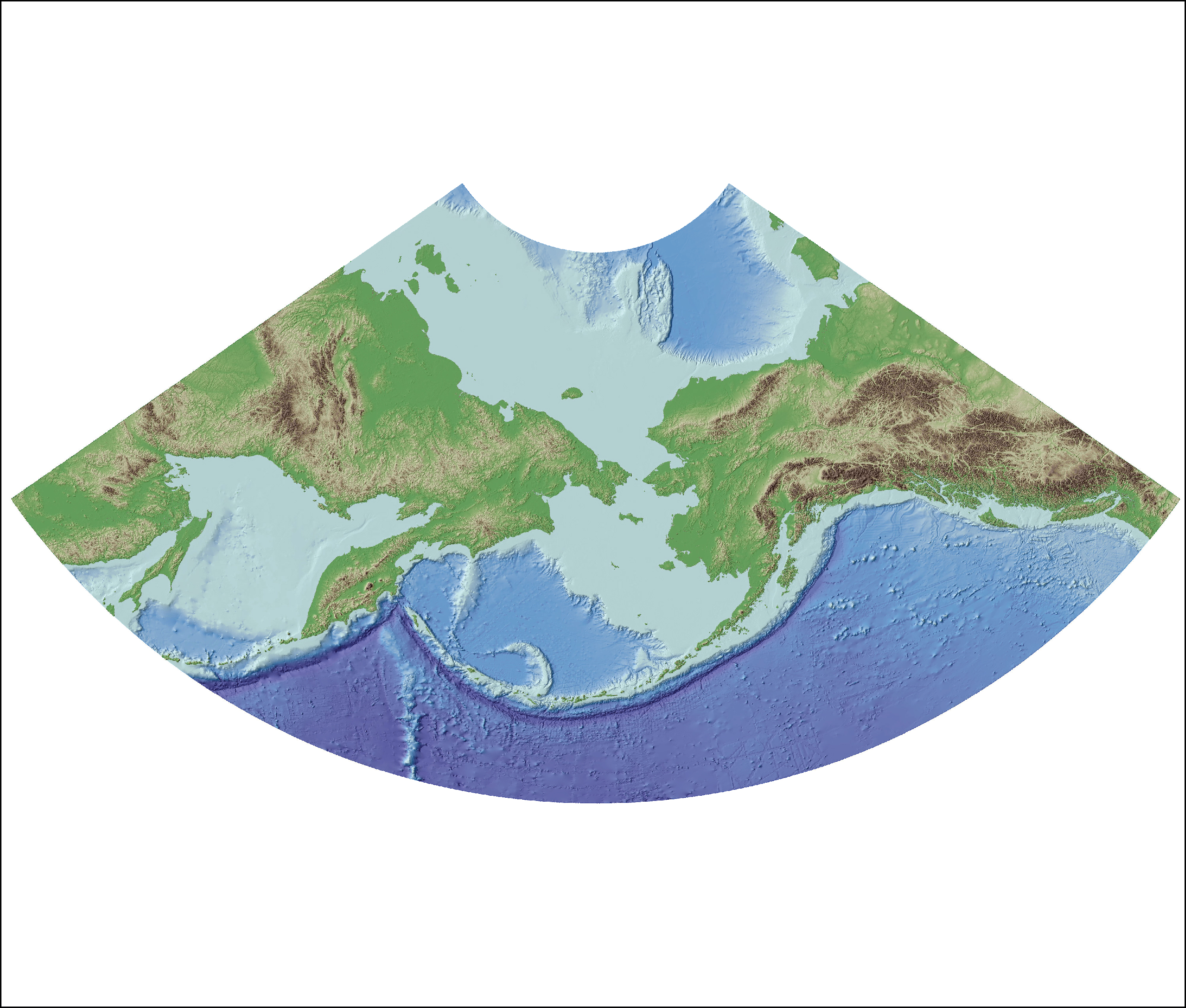
Beringia basemap
|
Beringia basemap provided by the University of Alaska Fairbanks tif digital elevation model
full dataset and description available from the UAF ARDEM website |
Quartz-rich crystalline bedrock units of Alaska
|
Quartz-rich bedrock units extracted from bedrock geologic map of Alaska kmz google earth file pgn ESRI polygon shapefile |
 |
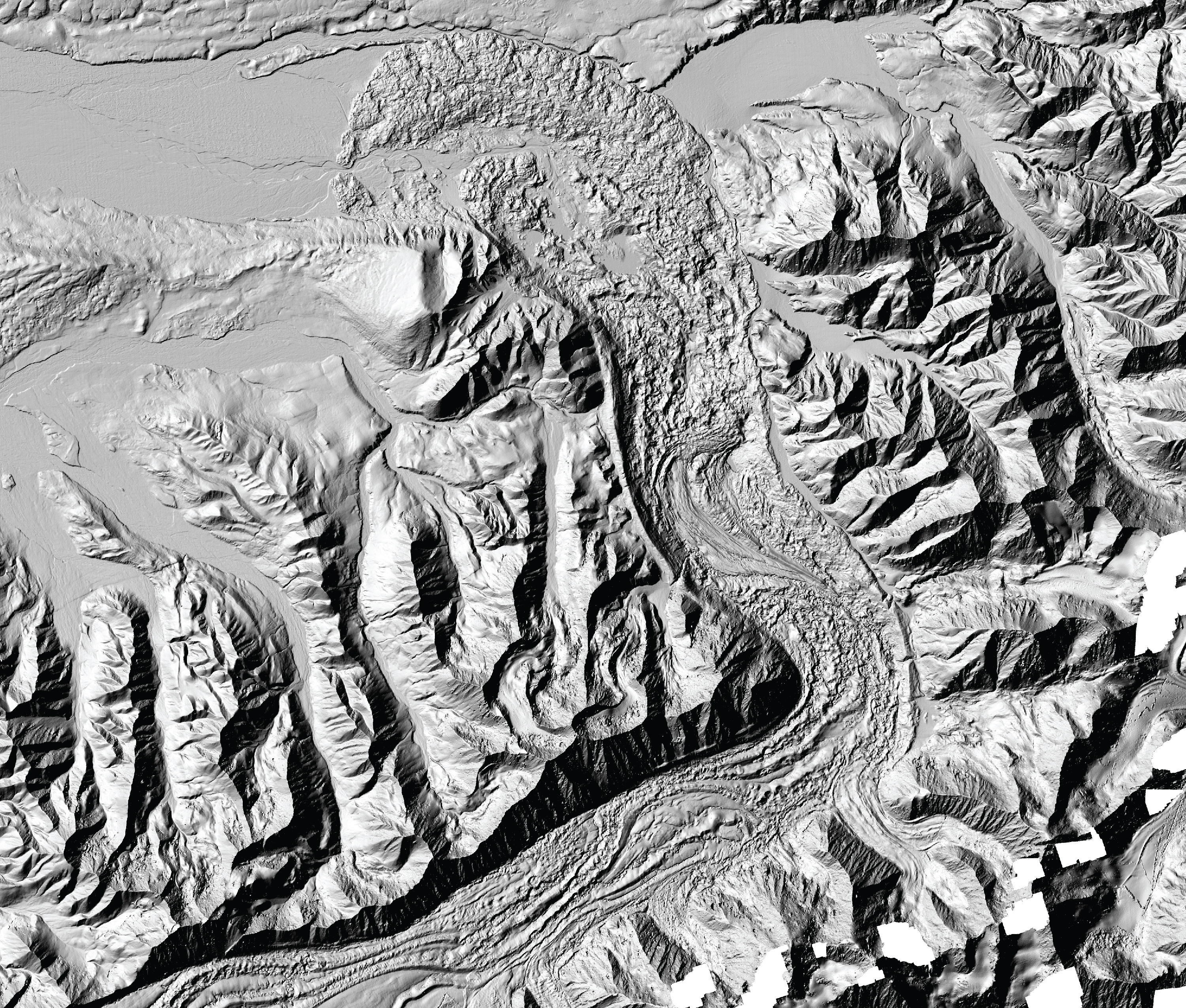
The Polar Geospatial Center's Arctic DEM at 2 m resolution covering most of the arctic including Alaska below example: the Muldrow Glacier in Denali National Park |
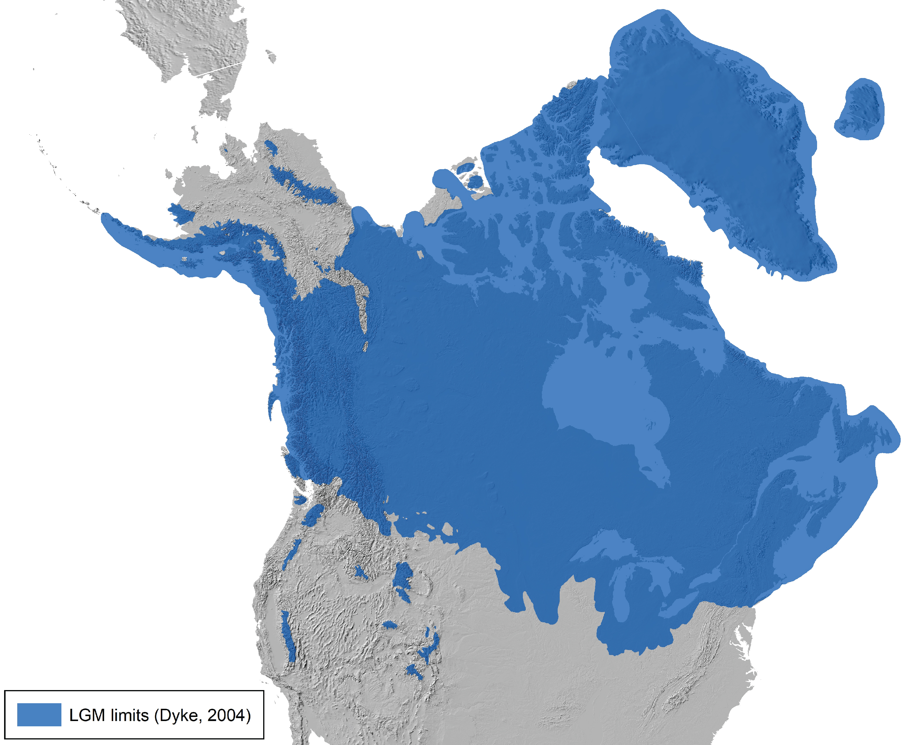
21.0-1.0 ka timeslice of ice-sheet limits for North America (Dyke, 2004) Note: in Alaska, the glacier extents are depicted as the larger expansions of the early Wisconsin rather than the smaller late Wisconsin limits that are documented in this atlas. update coming soon available here |
|
|
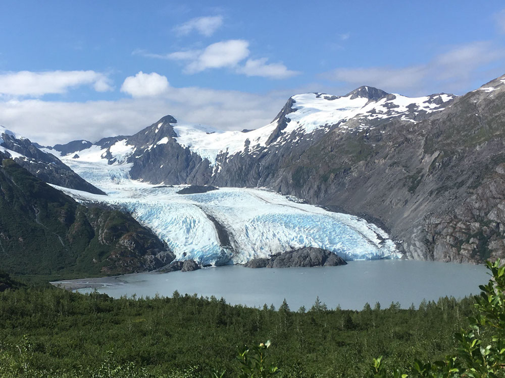
contributors: Jason Briner jbriner@buffalo.edu and Joseph Tulenko jptulenk@buffalo.edu UB Geology Department website and Glacier History Lab website Webpage updated from the orginal Alaska Paleoglacier Atlas designed by William Manley william.manley@colorado.edu and Darrell Kaufman darrell.kaufman@nau.edu top photo credit: Jason Briner, Portage Glacier, eastern Kenai Peninsula |